India:
Indian Monsoon Data Assimilation and Analysis reanalysis (IMDAA)
1979-2018 hourly, 3 hourly, daily, and monthly
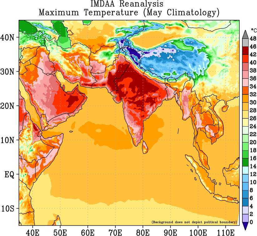
The Indian Monsoon Data Assimilation and Analysis reanalysis (IMDAA) is a regional atmospheric reanalysis over the Indian subcontinent. The IMDAA is the result of collaboration among the Met Office (MO), U.K, National Centre for Medium Range Weather Forecasting (NCMRWF), India and the India Meteorological Department (IMD) with funding from the National Monsoon Mission (NMM) project of the Ministry of Earth Sciences, Government of India. The reanalysis runs are carried out using high resolution (12km) mesoscale version of the Met Office Unified Model (UM) from 1979 to 2018, to span the era of modern meteorological satellites.
The IMDAA system is based on the Met Office four-dimensional variational assimilation scheme(4DVAR) and its Unified Model (UM). The system uses an intermittent data assimilation cycle. The model domain extends wider than the Indian subcontinent so as to include areas important for the development of Indian monsoon.
Horizontal grid resolution of the reanalysis model is 12 km (0.11) and it has 63 vertical levels reaching to a height of approximately 40km. Lateral boundary conditions for the reanalysis run are taken from the global reanalysis ERA-Interim. Sea surface temperature is specified from the Hadley Centre Ice and Sea Surface Temperature dataset version 2 (HadISST2). Soil moisture analysis produced by the Extended Kalman Filter (EKF) based land data assimilation system, is used to update the soil moisture fields in every assimilation cycle.
There is a webpage to get data and more information
I need wind speed data in…
I need wind speed data in time steps of seconds.
need data for research…
need data for research purpose