Web pages that plot or show plots of data
Ocean WRIT (Web-based Reanalysis Intercomparison Tools) from NOAA/PSL.
New! Watch 2020 AGU talk
 Plot maps and cross-sections, time series, and correlation maps using various ocean reanalysis. Compare datasets and years. Analyze and compare time series. Includes GODAS, ORAS5, SODA3-JRA55, SODA3-ERAI, ECCO. Also some JRA55 surface fields, GPCP precipitation, and SST datasets.
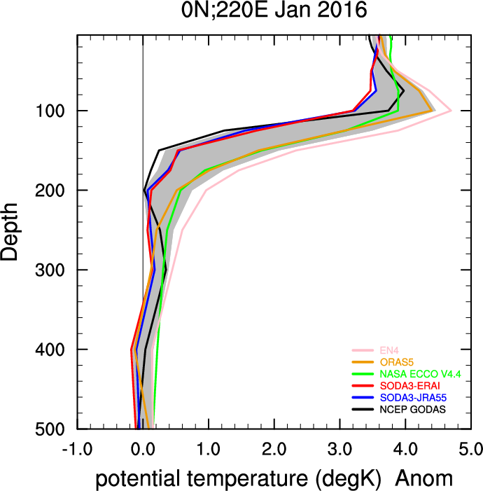 New Tool! Ocean WRIT Vertical Profile Tool. Plots profiles at depth with multiple ocean reanalyses (mean, climatology, anomaly) and can plot spread at a grid. Also plots timeXdepth and great circle transects at depth. Reanalyses include ORA5, GODAS, ECCO, SODA(s), and EN4 analysis.
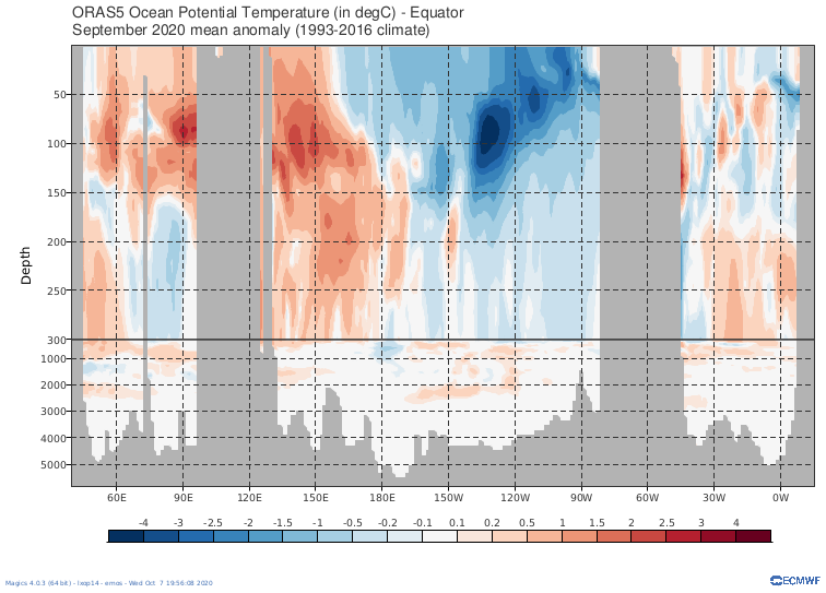
ORAS5 Plots
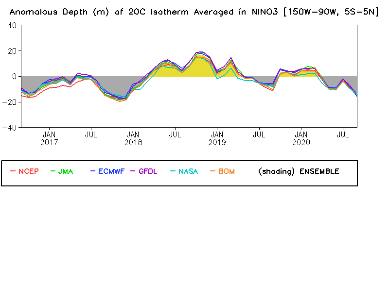
Multiple Ocean Comparisons at NOAA/CPC
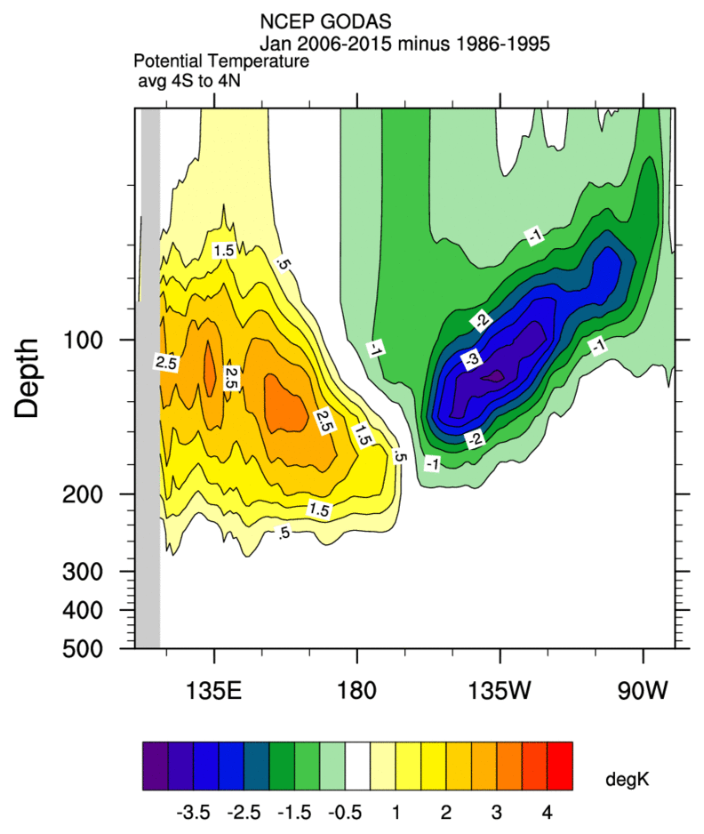
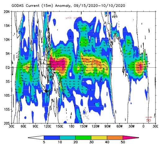
GODAS NOAA/CPC Plots
There are various ways to do…
There are various ways to do that. The data is OPeNDAP enabled so any app that will read opendap data can extract a timeseries
https://psl.noaa.gov/thredds/catalog/Datasets/20thC_ReanV3/catalog.html
https://psl.noaa.gov/data/gridded/tools.html
You can get a timeseries with our subsetter
https://psl.noaa.gov/cgi-bin/db_search/DBSearch.pl?Dataset=NOAA/CIRES/D…
select a single grid by have lat1=lat2 and lon1=lon2. You may need to split up year ranges.
You can get a time series at a point for some monthly variables
https://psl.noaa.gov/cgi-bin/data/testdap/timeseries.pl
For some daily and subdaily variables, see
https://psl.noaa.gov/data/timeseries/hour/
https://psl.noaa.gov/data/timeseries/daily/
re: There are various ways to do…
Thank you! It will try to did into this.
Also, it there a way to extract data from a long list (>100 000) of precise time and location. Any surface reanalysis after 1989 would be OK. I am thinking of an API or something like this.
I'm not sure what the…
I'm not sure what the question means. What is the long list of? What are the precise times and locations of? Are you looking for a map of values?
Cathy
MJO + ENSO
Hello All
Please guide; how to make map of previous years of precipitation or 500mb geop anomaly included mjo phase and ENSO
I could not fine it
How to extract temporal sequene from 20th CR v3
Hi,
I would like to extract temporal sequence from 20th CR v3 for a site, instead a sequence of map.
Is their any easy way of doing this?